32 kilometers from the city of Kitab (Kashkadarya region) there is an amazing mountainous area called Sukar. Translated from Tajik, "sukar" means mountain. From the northern part, Sukar is surrounded by the Karakhan Mountains. From here, a beautiful view of Khazrati Sultan Peak (4643m), which is considered the highest point in Uzbekistan, opens from the mountainous terrain. This mountainous area many centuries ago served as a place of defense of local residents (Sogdians) from the invasion of the troops of the Arab caliphate.
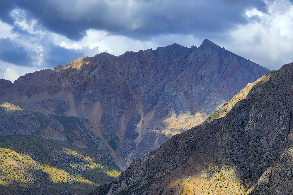
Khazret Sultan Peak
In 774, there was an uprising of "people in white clothes" under the leadership of Mukanna, the leader of the liberation movement, who opposed the influence of the Abbasid caliphate, which during the reign of Caliph al-Mahdi (775-785) covered the entire Transoxiana. The main location of the rebels was determined to be Mount Siam (Sanam). More than a hundred thousand troops, horses and food were stationed here. One of the main entry points to this natural mound is the village of Siam, which borders the mountainous region of Sukar and Karakhan on the north side, separated by a rocky wall resembling an eagle's beak. Through the mountain crossing you can go to the sacred area "Kabri Shahidon", and from here after 3 km to Mohi Kesh (translated as "the lunar path to Kesh (the ancient name of the city of Shakhrisabz)".
 Since the way was strategically very convenient, the rebels under the leadership of Mukanna formed a defensive post at this place. As a result, fierce fighting between rebels and Arabs took place in this area, during which hundreds of people were killed and buried in the juniper forest. This place was later called "Kabri Shahidon" (translated from Tajik as "tomb of the martyrs"). Currently, the cemetery is located above the road coming from Sukar. The picturesque area is decorated with ancient archies, whose age is 70-80 thousand years.
Mohi Kesh - was one of the main observation points of the rebels. Thanks to the moonlight, a kind of lighthouse was installed here at the highest point of the mountain, through this lighthouse they notified about the situation in the city. And from the top of Khazrati Sultan (Sanam), the urban surroundings of Karshi were viewed.
Because of the reflection of the moon in the well, and also because from the top the locals called this area Mohi Kesh. From the top of the mountain, the valley of Kesh and Hazrati Sultan (Sanam) were fully visible. The area had strong external and internal defenses.
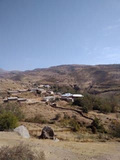
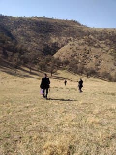
 To protect Mohi Kesh from the attack of troops coming from Kabri Shahidon, large groups of troops and border posts were organized on the ground. After the suppression of the Mukanna uprising, the lighthouse was destroyed. Today, the local population continues to visit this area, supporting the ancient teachings of Mukanna. In the lower course of the Siab River there is a unique leaky stone "Teshik Tosh". Locals say that if you pass this stone, you can get rid of your sins. On the eastern side is Mount Sukar, on the south-western side is the village of Govhana, and the north-western part has been turned into pasture. The locals, who were once hermits, were relocated to the plains. One of these villages is the Chohak mound, located in a lowland on the north side of the road leading to Mount Sukar. It is also sometimes called Choak, Chok.
Here were the main roads leading to Hissar from Palandara, a small village in Kitab district. This place was a strategically convenient route for trade caravans coming from Kesh, and for operational military operations. In addition, on a flat area of 2 thousand hectares between the Jinny Darya and Aksu rivers, it was possible to maintain a strong defense with the help of a horse herd.
The locality of Chohak is famous for historical events. The ruler of the Karakhanid state, Bugrakhan, who victoriously invaded Transoxiana in 992, after defining his borders, falls ill and begins to live in this place, choosing the province of Kesha as his residence. Therefore, the mountain originating in this place is called "Karakhan". After the relocation of Karakhanid Bugrakhan to the province of Kesh and his sudden death, power in Bukhara passes to the Ghaznavids and his leader Sabuktegin.
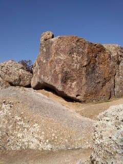
Currently, an earthen mound of 50 x 50 meters with the same name remains from this residence on Mount Karakhan in the Chokhak mound. On the south side of Chohak there is a blue stone measuring 1.2 x 0.4 x 0.3 meters, on which a surah from the Quran "Ayat al-Kursi" is carved. Spring water flows from the north side of the Mound. On the right bank of the water, you can see large boulders, and petroglyphs on the rocks, on which images of deer are carved.
Source of the material Kitobsayyoh.uz
Working hours: 9:00 AM - 6:00 PM, Mon-Fri
For any questions


 UZB
UZB RUS
RUS CN
CN JPN
JPN ARA
ARA FRA
FRA DE
DE POR
POR ESP
ESP TUR
TUR ITA
ITA HIN
HIN MAL
MAL
Comment